Additional information
| Weight | 0.25 lbs |
|---|---|
| Dimensions | 12 × 11 × .1 in |
$8.00
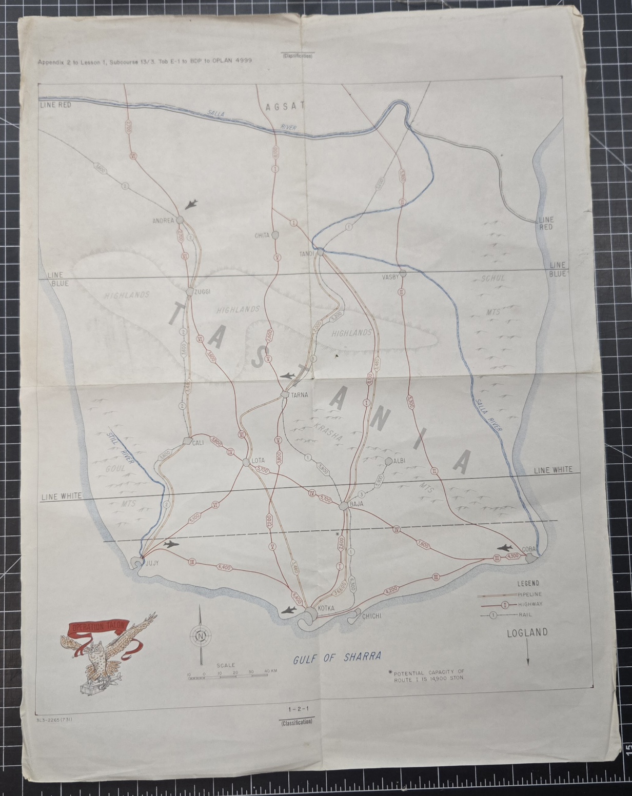
Cold War-era fictitious training map titled Operation Talon, measuring 16 x 21 inches. This full-color printed map was likely part of a military field exercise scenario set, designed for use in staff or command post training. Though undated, the style and printing suggest a 1970s origin, aligning with standard U.S. Army Cold War training materials. The map outlines a fictional region with clearly marked military objectives, boundaries, and terrain features, mimicking real-world geography for planning and coordination exercises. A unique collectible for Cold War historians, wargamers, or military educators.
Out of stock
| Weight | 0.25 lbs |
|---|---|
| Dimensions | 12 × 11 × .1 in |
Only logged in customers who have purchased this product may leave a review.

Reviews
There are no reviews yet.